
|
|
Body of Report |
|
|
|
No city played a more important
role in shaping the landscape and economy of the mid-continent during the
second half of the nineteenth-century than Chicago... the central story
of the nineteenth-century West is that of an expanding metropolitan economy
creating ever more elaborate and intimate linkages between city and country.
|
INTRODUCTION
Protection of unique and significant natural and cultural resources in the Calumet region of northeast Illinois and northwest Indiana has long been a goal of many citizens and public and private organizations. Small, scattered remnants of these resources have survived more than 150 years of exploitation, industrialization and urbanization. Initiatives have been advanced and organizations chartered for the sole purpose of protecting specific natural, cultural and recreational resources.
In 1968, the Chicago Tribune reported that the Lake Michigan Region Planning Council indicated that a plan for the Little Calumet River corridor was necessary to balance the "... need for natural open space ..." by providing for natural recreational areas to include parks, forests and game preserves, while also providing lands for anticipated future growth throughout the region. The council found that because the region's expanding population was "sandwiched" between an industrial "steel coast" to the north and highly productive farmland to the south, the river corridor was instrumental in accommodating a growing population and preserving much needed natural areas for environmental and recreation uses and quality of life.
In January 1985, the Lake Calumet Study Committee, a private non-profit group, announced a proposal for the creation of a 2500-acre "wetland ecological park -- open space recreation area" in the Lake Calumet area (initial park proposal encompassed that portion of the Calumet River watershed located in the south Chicago metropolitan area of Illinois). The wetland component would emphasize landscape, habitat and wildlife preservation, while the open space component would provide a variety of open space and recreational opportunities. Goals for the establishment of this park included reversing environmental degradation in the area, reducing the decline of property values and reducing pollution and high rates of human disease in south side communities. The committee has actively promoted this park proposal since its initiation and, subsequently, expanded the proposed area to include several environmental corridors extending through northwestern Indiana to Indiana Dunes National Lakeshore. In 1993, the Calumet Ecological Park Association was formed to provide interested citizens the opportunity to actively support the park proposal. The association promotes preservation of natural lands and habitat in the Lake Calumet region highlighting historical and cultural aspects, of area communities and revitalization of area economy.
In May 1994, the House Subcommittee on Interior held a hearing, where former Congressman George E. Sangmeister (11th Congressional District, Illinois) urged continued congressional support of the National Park Service's efforts "to enhance Lake Calumet and the Greater Chicago region." Congressman Sangmeister recognized "the farsighted vision of the Lake Calumet Ecological [Park] Association and commended their efforts to preserve important plant and animal species and to connect fragmented urban natural resources throughout the southern Chicago metropolitan area." Understanding the potential for interconnecting open space as regional systems, the Congressman acknowledged the association's vision and noted that its efforts paralleled those of the National Park Service through the ChicagoRivers Demonstration Project to enhance environmental and recreational resources associated with the Chicago and Calumet waterways. Envisioning the significance of such an opportunity, the Congressman's testimony emphasized the enormous social and ecological value afforded by [that would certainly result from] such an effort through National Park Service's the Rivers, Trails and Conservation Assistance Program.
In May 1993, the National Park Service conducted a preliminary site inspection of the Lake Calumet area at the request of Congressman Sangmeister. Results of this inspection indicated that although some of the area's distinctive natural features were evident, most of these resources had been drastically changed. Rivers had been altered and landfills covered the original topography. However, the resources that remained were found to be important. Although these resources are similar to those represented on the west end of the Indiana Dunes National Lakeshore, they are still very different. The report concluded that the site posed a problem with its development and maintenance due to existing hazardous wastes, and alteration of natural resources. The report recommended that further consideration of Lake Calumet for addition to the national park system should not be supported. However, the report did state that the National Park Service could play a cooperative role in the development of the area."
In April 1996, Congressman Jerry Weller requested the assistance from the National Park Service's Rivers, Trails, and Conservation Assistance Program to develop a regional system of greenways between the Illinois and Michigan Canal Heritage Corridor and the Indiana Dunes National Lakeshore. The purpose of this greenway system is to enhance and protect the area's natural treasures, as well as its cultural and historical resources. In response, the Director of the National Park Service acknowledged a need to protect these resources and to provide long-range planning in the region. This area is a highly complex and fragmented landscape requiring substantial collaboration of many participants.
Congressman Weller further announced plans to introduce legislation supporting a study by the National Park Service to determine the potential of the Calumet Ecological Park proposal for Chicago's south side and the south suburbs. This bill was ultimately combined with a variety of related initiatives and signed into law on November 12, 1996, as the Omnibus Parks and Public Lands Management Act of 1996 (Appendix A). In announcing the study proposal, Congressman Weller indicated the goal would be to preserve "...open space and wildlife habitat while continuing hand in hand efforts to revitalize this area and bring jobs back to the south suburbs and south side."
The Omnibus Parks and Public Lands Management Act of 1996 directed the Secretary of the Interior to "...conduct a study of the feasibility of establishing an urban ecological park to be known as 'Calumet Ecological Park' in the Lake Calumet area...". The study includes three principles:
- The suitability of establishing a park that "...conserves and protects ... natural resources threatened by development and pollution ... and ... consists of a number of non-adjacent sites forming green corridors between the Illinois and Michigan Canal National Heritage Corridor and the Indiana Dunes National Lakeshore, that are based on the lakes and waterways in the area."
- The long term future use of the Lake Calumet area."
- Ways in which Calumet Ecological Park would ... "benefit and enhance ...cultural, historical, and natural resources of the Lake Calumet area and northwest Indiana."
Although the national park system does not include an "ecological park" designation, an initial review of the legislation and news articles as well as discussions with local interest groups led study team members to believe that a traditional study - one which would evaluate the Calumet region for potential addition to the system - would be most appropriate. Accordingly, the study was expanded to include the consideration of cultural, historic and recreation resources. Subsequent discussions, public forums and news articles, however, clarified local intent regarding the National Park Service involvement as one of coordination, consistent management and technical assistance. As a result, the study team evaluated various national park system designations as well as more cooperative approaches with strong, local partnerships.
The National Park Service conducts studies of potential additions to the national park system and other special designations as directed by Congress. These studies, known as special resource studies, evaluate resources within an established study area based on the specific qualifying factors of the national park system and identify appropriate management strategies for resource protection and public enjoyment. The purpose of such studies is to provide Congress with professional information to be considered along with other policy, management, and budget considerations when determining whether or not to add potential areas to the national park system.
Special resource studies are prepared in order to determine if an area is nationally significant, suitable, and feasible. Areas which meet these elements are considered eligible for inclusion in the national park system. For a resource to be nationally significant, it must meet the following criteria:
- It is an outstanding example of a particular type of resource.
- It possesses exceptional value or quality in illustrating or interpreting the natural or cultural themes of our Nations heritage.
- It offers superlative opportunities for recreation, for public use and enjoyment, or for scientific study.
- It retains a high degree of integrity as a true, accurate, and relatively unspoiled example of the resource.
The national park system is only one part of a much larger national system of parks and protected areas. Criteria for suitability address the concept that the national park system assure that major themes and facets of the nations natural and cultural history are protected and available for public enjoyment. A determination of suitability for inclusion in the national park system requires evaluation of how a particular type of resource is currently represented in existing units as well as in other areas managed by Federal, State or local governments and the private sector. If a resource type is adequately represented in existing national park system units or other areas that are comparably managed for protection and public use by other entities, it is not considered suitable for addition. Evaluations of suitability must define what category of resource type is under consideration so that the study can compare and contrast the study area with similar resources.
The feasibility element of the study process analyzes the potential for successful management. Important considerations include size and configuration, land ownership, current and potential uses, acquisition costs, accessibility, threats to resources, staffing or development requirements, and public interest in acting to protect and manage the area. An evaluation of feasibility considers the resource in the context of natural systems and historic settings and other factors necessary to ensure long term protection and to accommodate public use. For those areas to be managed by the National Park Service, special attention is given to the potential for efficient administration at reasonable cost.
Although Congress did not appropriate funds specifically for completion of the feasibility study, the National Park Service allocated a small level of funding from its planning budget during Fiscal Years 1997 and 1998. A study team, composed of National Park Service resource staff (Appendix B) was organized in April 1997. The initial team meeting was conducted in May 1997. The study process follows applicable National Park Service and Department of the Interior policies and guidelines, principally "Criteria for Parklands" and "Pre-Authorization Studies and Decision Making." During the study process, team members consulted with individuals, public and private organizations, members of Congress, States of Illinois and Indiana officials, local governments, corporations, education institutions, Federal agencies and other groups (Appendix C). This report to Congress is a culmination of findings of many studies and scientific investigations, site visits, discussions with local resource experts and statements from various sources, public meetings and workshops. A summary of public meetings and forums conducted in conjunction with the feasibility study is contained in Appendix D.
The boundaries of the study area were established by the team based on the legislation and information provided by the Calumet Ecological Park Association and the Lake Calumet Study Committee. Initially, the eastern and western boundaries were established to include areas between the Illinois and Michigan Canal National Heritage Corridor and the Indiana Dunes National Lakeshore because this area was specifically referenced in the legislation (P.L. 104-333, Section 816). (a) (1) and (a) (2) (A) (ii)). The western boundary was subsequently extended to encompass the Pullman Historic District. The southern boundary, located one-half mile south and west of the Little Calumet River, and the northern boundary, which is the natural and constructed lands forming the Lake Michigan shoreline, were established to encompass the "green corridors" delineated by the Calumet Ecological Park Association. The study area encompasses 160 square miles and approximately 580,000 people. The boundaries for the feasibility study are delineated on the Map 2, Study Area.
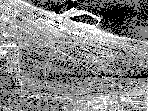
The study area encompasses portions of northwestern Indiana and northeastern Illinois, including parts of Porter and Lake Counties, Indiana, and Cook County, Illinois. This area is characterized by remnant beaches, marshes, moraines, small ponds and slow moving rivers created by receding glaciers. Located at the southern end of Lake Michigan, the area was once a wilderness of dunes, lakes and marshes. By 1840, railroads traversed the region and settlements began to destroy the natural areas. As Great Lakes shipping increased and harbors were developed industrialization occurred rapidly through the region. This industrialization and related urbanization resulted in the dramatic alteration of this area.
The area east of Gary along Lake Michigan contains one of the most remarkable regions in America, the Indiana Dune country. This area is covered by a series of parallel sand ridges and intervening low areas (swales) filled with ponds and marshes. The wide, sandy beach separating the Lake and the dunes is ever-changing due to water and winds. The stable or "dead" dunes were covered by a forest of white pine (the southern extent of the northern boreal forest), while "live" dunes remained bare, constantly changed by wind. Not all of the dune country is sand. There are acres of forest, fertile lowlands, vegetated valleys, spring-fed streams, and swamps. Eastern deciduous forests, boreal (arctic) remnants and tall grass and mixed-grass prairies converge on the southern shore of Lake Michigan. More than 1,300 species of flowering plants and ferns are found in this area, including desert plants, rich woodlands, pinewoods and plants of the swamps, oakwoods and prairies. The prickly pear Cactus, a southwestern desert species, grows side-by-side with the bearberry, an arctic species. The jack pine, the most common dune pine, reached its farthest southern growth in this area. Between the beaches of Lake Chicago and the dune belt is a strip of marshy meadowland. An inferior quality of peat is also found here, which burns indefinitely after marshes have been swept by a forest fire. Vegetation patterns which existed in the study area prior to development are illustrated on Map 3, Pre-Settlement Vegetation.
The area is located in the central lowlands physiographic province and is characterized by extremely flat topography, shaped by glaciation and Glacial Lake Chicago wave action. The southern extent of glaciation is believed to be slightly south of Indianapolis. As the glacier receded northward, morainal deposits occurred, the most conspicuous of which was the Valparaiso Moraine. The lake plain located north of the Valparaiso Moraine, was once covered by Glacial Lake Chicago. As the edge of the ice sheet receded northward, the water from the melting glacier and from rains formed a lake between the glacier to the north and the moraine to the south. The lake continued to rise until it overflowed through a channel called the "Chicago Outlet, which was located near the City of Chicago. Lake Chicago is the name applied to all stages of the lake from the time of the first opening of the Chicago Outlet until its final closing. The waters of Lake Chicago was once about 60 feet above the present level of Lake Michigan.
This final retreat of its waters left a series of beaches identified in order of their formation as the Glenwood (13,500 to 12,400 years ago), Calumet (11,800 to 11,000 years ago), and Tolleston Beaches (6,300 years ago to present). The Glenwood Beach, named for the Village of Glenwood, Illinois, where the lake is well-exposed, is about 55 feet above the present level of Lake Michigan. Calumet Beach lies just to the south of the Little Calumet River. In Lake County, the beach is about 20 feet below the Glenwood stage, and is easily traced along Ridge Road from Munster through Highland to Glen Park in south Gary. Following the Calumet stage, the level of Lake Chicago fell about 15 feet. At this point, Tolleston Beach was formed which was from 20 to 25 feet above the present level of Lake Michigan. Tolleston Beach was named for the Village of Tolleston, which is now a part of Gary. Tolleston Beach, which was formed over the past 4,500 years, was created by wave and current action depositing stream sediments along the shoreline as the lake level lowered.
In the northwest section of the strandplain a series of shallow lakes was captured by sand spits as Lake Michigan receded. A large series of ridges and swales marked stages in the evolution of the strandplain. The youngest ridges and swales are closest to the lake, while the oldest are furthest away. Along the immediate shoreline of Lake Michigan, beach and foredune communities formed, while panne communities inhabited the interdunal depressions that form on the lee sides of the first and second line of dunes. Pannes are calcareous wetlands and ponds that formed in depressions that intersect the ground water table. Pannes contain unique species of flora that are not known to grow elsewhere in the Chicago Region or the State of Indiana (Labus and Whitman, 1997). MAP 3: Pre-Settlement Vegetation.
When the Calumet region was settled, the natural communities of the strandplain formed a transition from sand savanna and sand prairie associated with the dune region in the east to tallgrass prairie in the west (Labus and Whitman, 1997). The area's geological history, combined with the convergence of three major biomes (eastern deciduous forest, boreal remnants, and tall grasslands), resulted in one of the most biotically diverse regions in the country. Prior to 1810, the Little Calumet and Grand Calumet Rivers were two reaches of the same river, referred to as the Grand Konomick River. At that time, the Grand Konomick River flowed along the path of the Little Calumet River south of the Tolleston Beach Ridge. Flowing from Indiana to Illinois, the river reversed course in a low area between the Tolleston Beach Ridge and the moraine at Blue Island. The river then flowed eastward into Indiana, roughly following the path of the Grand Calumet River where it eventually discharged into Lake Michigan near the existing Grand Calumet Lagoons.
Development of the Calumet Region
Sometime before 1820, a small channel opened between the elbow in the Calumet River south of Lake Calumet and the Grand Konomick River, possibly due to Native Americans traveling through the area by canoe. This created two rivers - the Little Calumet River, which flowed west from Indiana and discharged to Lake Michigan through the Calumet River, and the Grand Calumet River, which flowed east and discharged into Lake Michigan. Between 1840 and 1845, the diversion of water from the Grand Calumet River reduced the flow enough that beach and dune deposits blocked the mouth of the channel and prevented flow into Lake Michigan. Under these conditions, the Grand Calumet and Little Calumet Rivers both originated in Indiana and flowed westward into Illinois meeting the newly extended Calumet River and discharging into Lake Michigan. These rivers were surrounded by extensive wetlands.
Prior to 1840, Lake George, Wolf Lake, Berry Lake, and Long Lake and the surrounding wetlands occupied shallow depressions between the dunes and ridges north of the Grand Calumet River. Between 1872 and 1881, Hyde Lake and Deer Lake were formed, probably due to a lowering of water levels when channels were dug between Wolf and Berry Lakes. The decrease in lake levels most likely resulted in the emergence of previously submerged sand ridges, forming Hyde Lake in what has been the western part of Wolf Lake, and Deer Lake in what had been the western part of Berry Lake. Lake Calumet had a depth of about 10 feet in 1840 and was surrounded by wetlands that extended to the Calumet River. The extent of these wetlands was limited by higher ground levels associated with Blue Island, Stony Island, and beach ridges near the Calumet River. Lake Calumet varied in size with the levels of Lake Michigan.
Industrialization of the region began with the laying of railroad tracks in the mid-1800's. Between 1850 and 1900, at least nine railroad companies laid track through the area to connect Chicago with the East Coast. Large-scale industrial development in the Calumet region began in 1870 after the U.S. Congress authorized funding to build Calumet Harbor. Water access and rail connections for shipping, abundant water for processing, and proximity to expanding markets in the Midwest and western United States made the Calumet region a desirable location for manufacturing steel, railroad cars, brick and tile; mining sand, gravel, and clay; processing petroleum; and conducting meat packing. Industrial development spread from Calumet Harbor as access to Lake Michigan was improved. The channel of the Calumet River was straightened around 1886 and the Grand Calumet River channel was diverted several hundred feet south of its former channel to accommodate industrial development near Gary Harbor. In addition, the Indiana Harbor Canal (1906) and the Calumet Sag Channel (1922) were dug, and Burns Harbor and Burns Ditch were constructed (1926). During construction of Burns Ditch, the channel of the Little Calumet River was straightened and relocated. Several meanders in the Calumet River were also straightened to improve its navigability. These changes shifted the natural drainage of the region from the St. Lawrence to the Mississippi River system.
In addition to altering the area's rivers, industrialization and waste disposal resulted in the modification or elimination of many lakes and wetlands. By 1927, Hyde, Deer and Berry Lakes were filled for industrial land uses. The shorelines of Lake Michigan, Lake Calumet, Wolf Lake and Lake George were substantially modified since 1870 because of infilling associated with industrial development and waste disposal. Water disposal of solid waste was regulated by Indiana, who allowed industries to create land by infilling Lake Michigan. Similar practices occurred in Illinois. Fill in Lake Michigan was accomplished by first sinking sheet pilings into the lakebed to form a seawall. The area between the shore and the seawall was backfilled with lake sand and industry waste. By the late 1970's, approximately 3,689 acres of Lake Michigan had been filled in the Indiana part of the study area. In addition approximately 60 square miles of land in the study area, including both States, had been deposited with steel slag, ranging from 5 to 60 feet deep. In a large part of the study area, the tops of the sand dunes and beach ridges were scraped off and used to fill adjacent wetlands to make way for residential and industrial development. Disposal of solid wastes and dredging spoil in lakes and wetlands was deemed desirable for several reasons. Unwanted wastes were disposed of, land that could be used for industrial and urban expansion was created and breeding grounds for mosquitoes and other pests were reduced or eliminated.
Settlement and intensive industrialization caused significant fragmentation and losses to physical habitat, as well as impacts from contamination and pollution. For example, the Indiana portion of the strandplain that once covered approximately 30,000 acres has been reduced to approximately 2,000 acres. Roughly half of the remnant natural landscape falls within the study area in isolated pockets ranging in size from 5 to 170 acres. There are roughly 1,000 acres of remnant strandplain landscape in the Miller Woods area, most of which is located within the boundaries of the Indiana Dunes National Lakeshore. Most of the lakes and wetlands were filled, often with steel slag or other waste with high amounts of heavy metals and other contaminants. The Grand Calumet River receives 90 percent of its flow from industrial and municipal discharges and has a history of high levels of bacteria, nutrients, cyanides, lead, arsenic, cadmium, PCBs, phenols, hydrocarbons, chlorides, and other contaminants in the water column and bottom sediments (Whitman, et. al. 1997).
A variety of community types and overlapping biomes are represented in the study area. The eastern end of the study area is drier and more open than areas only a few miles to the east. Sites in this part of the study area have sandy soils that support a mosaic of sand prairie and oak barren communities on the upland ridges. Wet prairie, sedge meadow, marsh and shrub swamps occur in the intervening swales. The western part of the study area, in Illinois, was once predominantly tallgrass prairie. Sandy soils are less frequent, woodlands and savannas are mostly limited to stream margins and morainal ridges, and a variety of wetlands are interspersed throughout the area. Natural areas evaluated inconjunction with the study are delineated on Map 4, Important Natural Resources and summarized in Appendix E.
The Nature Conservancy has designated the southern Lake Michigan lakeplain as the Greater Calumet Wetlands Megasite. The study area includes the following subsections of the megasite: Lakeside Ridge and Swale; Inland Ridge and Swale; Tolleston Beach; and Lake and Marsh Section. These subsections are based on landform and relative age. The ancient beach ridges and intervening swales of the strandplain run parallel to the modern shoreline of Lake Michigan east of the Lake and Marsh Section. The ridges and swales are divided by the Grand Calumet River into two distinct sections. The Lakeside Ridge and Swale Section is lakeward of the Grand Calumet River and is relatively younger than the Inland Ridge and Swale Section landward of the river. The entire ridge and swale complex formed within the modern day limits of lake level fluctuation within the past 4,500 years.
The Lakeside Ridge and Swale Section includes the younger ridges and swales in the northeastern part of the study area. This area is relatively open and alkaline and includes sites such as the Clark and Pine complex. The ridges were formed within the modern day limits of lake level fluctuation within the past 6,000 years. A variety of wetland community types occur within the Lakeside Ridge and Swale section, often in earlier successional stages. Among these community types are globally rare pannes, which are characterized by an assemblage of rare plants that are adapted to calcareous or alkaline soil conditions. The ridges harbor upland communities such as globally rare sand prairie and sand savanna, depending upon moisture regime. There is exceptional biotic diversity in these areas where boreal and Atlantic coastal plain relicts occur together with prairie species more typical of the Great Plains. Clark and Pine Nature Preserve has a higher concentration of rare and endangered species than any other site in Indiana. (Map 4: Important Natural Resources)
The Inland Ridge and Swale Section contains several high quality natural areas that include: Ivanhoe Dune and Swale, Gibson Woods, Tolleston Ridges, and Brunswick Savanna. The ridges tend to be dominated by black oak savanna and sand prairie and the swales support a range of wetland communities including: wet prairie; sedge meadow; shrub swamp; and emergent marsh. There is remarkable plant diversity within each site as well as relative to each other. Gibson Woods and Ivanhoe Dune and Swale support 297 and 273 species of native plants respectively. Despite being separated by less than a mile, they share only 62 percent of their species in common.
The Tolleston Beach Section is older and further from the Lake than the inland section. In these sites, the sand savanna is denser, shrub swamps more common and wetlands more ephemeral. Included within this area are the Little Calumet River floodplain and Tolleston woods.
The Marsh and Lake Section occupies most of the Illinois portion of the study area and extends east into Indiana. This area includes Lake Calumet, Wolf Lake, George Lake and their surrounding marshes. Large areas of the lakes and marshes have been drained and/or filled and tend to be highly degraded. Marshes and shrub swamps are by these areas. Marshes are wetlands with emergent vegetation and are most often dominated by common cattail (Typha latifolia) or common reed (Phragmites communis berlandieri). Shrub swamps have at least 50% shrub cover and may be permanent or semi-permanent wetlands. Shrub species which commonly occur in these areas include: buttonbush (Cephalanthus occidentalis), red-osier dogwood (Cornus stolonifera), silky dogwood (Cornus obliqua) and sandbar willow (Salix interior). Although highly impacted, these sites tend to be very important for breeding and migratory birds. This subsection also includes a series of high quality remnants of native landscape. These natural areas are dominated by prairie but often include a variety of wetland and/or savanna communities. These remnants contain high floristic quality.
|
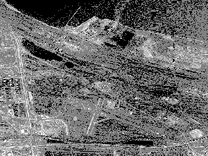
Plate 1. Tolleston Beach ridges and dunes from a 1938 air photo prior to construction of Gary, Indiana Airport. |
Plate 2. A 1978 air photo (right) of the Gary airport illustrates the dramatic loss of ridges and dunes. |
Also included within the study area are a number of high quality prairie remnants. The prairie remnants are primarily on the western edge of the study area, generally southwest of the Megasite, and often include wetland and/or savanna vegetation communities. These remnants contain high floristic quality and diversity. For example, Calumet City Prairie and Wentworth Prairie contain the highest rating ("very rare" Grade A prairie) according to the Illinois Department of Natural Resources. Prairies occur on black soil within a wide variety of soil moisture conditions and have native grassland species, such as lead plant (Amorpha canescens), big bluestem (Andropogon gerardi), and little bluestem (Andropogon scoparius). Sand prairie is a native grassland community that occurs on sandy soil. Species that characterize this type of prairie include big bluestem, little bluestem, and prairie coreopsis
(Coreopsis palmata). Savanna is an open woodland community with a grassy or herbaceous groundcover. The tree canopy cover can vary from 10-80%. Sand savanna occurs on sandy soils and is typically dominated by black oak (Quercus velutina).
The Calumet region takes on unusual prominence in the convergence of lake and land traffic on, at, and near the head of Lake Michigan, and has functioned as the crossroads of the western half of the continent. Before Europeans ever came to this part of North America, Native Americans crisscrossed the Calumet region using countless trails, including the Sauk Trail and Vincennes Trace. Native Americans settled the region in villages of various sizes and temporary campsites associated with seasonal migrations. The major villagessuch as at Merrillville and Blue Islandwere often identified with, but not immediately on, the major trails and trail junctions. Some villages, such as at Thornton and Hegewisch were associated with water features, and others were associated with wooded sites, such as at Worth, Westville, Thornton, Hammond or Blue Island. By the time the first Europeans appeared in the region, the Native American trails were well defined, and consequently used by explorers, hunters, traders, missionaries, soldiers, and eventually, settlers. European settlements tended to be located in the vicinity of Native American settlements, probably because they were drawn by the same natural features and transportation routes. Euro-American settlers tended to avoid the Calumet area early in the nineteenth century settlement of the region, however, because the dune and swale terrain were considered wasteland and unusable. "The thick timber on the major part of the [Valparaiso]moraine, the extensive marshes and wet prairies on the lake plain, and the sandy 'barrens' of the far-flung ancient beach deposits and modern dunes help to explain the singularly belated pioneer settlement of this otherwise strategically located region." (p. 274, Meyer, Circulation and Settlement Patterns of the Calumet region of Northwest Indiana and Northeast Illinois) Most of the physical evidence of this early period has been obliterated by subsequent urbanization, industrialization, and large scale re-shaping of the region that occurred in the late nineteenth and early twentieth centuries. Historic and cultural features evaluated inconjunction with the study are delineated on Map 5, Important Cultural/Historic Resources and summarized in Appendix E. Properties which have received a formal designation, either through a listing in the National Register of Historic Places or as a Chicago Landmark, are included in Appendix H.
Chicago, incorporated in 1837, quickly grew to be a commercial and industrial center. Its symbiotic relationship with the rich midwestern hinterland, its location with respect to transportation corridors, and the promotional efforts of land speculators made Chicago the major commercial city in the Midwest. Industrial development became a significant factor in Chicago's growth after mid-century. Chicago's location in the middle of the continent proved advantageous as it supplied the vast requirements of the railroad industry in the west and processed the grains and meat produced in its hinterland. Chicago's position as a major metropolis was cemented by the development of the Illinois and Michigan canal in 1848 that connected the Great Lakes and eastern shipping to the Mississippi River and Gulf of Mexico. Although it was recognized that the Calumet and Sag Valley would be a cheaper and easier route, Chicago boosters and speculators argued for using the Chicago River route. They pointed out that a great city would develop at the terminus of the canal and that it was better for this to be entirely within Illinois than to be shared with Indiana. For the most part, the Calumet region, then, did not share in Chicago's early development, and as late as the 1880s and 1890s, it was still relatively neglected. During this period, the Calumet region was utilized largely by sportsmen who were attracted by the hunting and fishing opportunities in the marshes and streams. Only an hour's travel by rail from Chicago, the region was frequented by wealthy sportsmen who secured land and built clubhouses. The remnant natural areas left in this region may be the legacy of this earlier sporting use, but it is difficult to trace this with any certainty. (Map 5: Cultural/ Historic Resources)
Industry began moving into the Calumet region in the late 1800s. Drawn by the large expanse of open available land, excellent rail and water transportation, access to large quantities of fresh water for industrial processes, and proximity to a rapidly growing urban area, corporations began to locate new facilities in the Calumet region. George Hammond established a meat-packing plant in 1869, in the location of the city that now bears his name. Other early industries included steel mills on the Calumet River, a glue/fertilizer plant, and lumber mill. In 1881, the South Works steel plant (became part of US Steel in 1901) was opened on the northwest bank of the Calumet River at Lake Michigan in East Chicago. By 1884, George Pullman had completed his railroad car plant and model town along the Illinois Central tracks at Lake Calumet. Standard Oil, in 1889, opened an oil refinery in Whiting that was to become the world's largest. A variety of heavy industries developed including the production of railway cars and equipment, soap, paint, chemicals, and cement, but the predominant industry to develop in the region was steel. Many of the other industries in the region were related to the production of steel, either utilizing by-products of steel manufacture, or fabricating finished products from steel.
The Calumet region steel industry developed rapidly in the twentieth century. By the 1920s, it was beginning to eclipse the Pittsburgh District for steel production. Plants developed in the Calumet region were able to employ the latest, most efficient technology, because they were established relatively late and had the benefit of large open spaces.
Adequate areas of flat land, provided with transportation facilities which permit the assembling of raw materials and the marketing of finished products over a wide area with relative ease, and an abundance of suitable water, in addition to adequate labor supplies, all have proved great assets. Although the sources of ore are distant, this material can be obtained relatively cheaply owing to lake transportation facilities. Coal, too, is distant and comes part of the way or all of the way by rail. This is the chief handicap under which the Calumet District labors in competition with the Pittsburgh Steel District, but the later development of the former has given it a more modern equipment, permitting the adoption of the latest practices for reducing costs of production, and thus largely, if not entirely, offsetting the handicap with reference to coal. (John Appleton, The Iron and Steel Industry of the Calumet District, 1925 p. 14)
To meet the needs of industry, harbors at Lake Calumet, East Chicago and Buffington were constructed; channels such as the Indiana Harbor Channel, Burns Ditch, the Cal-Sag Channel, and various modifications to the Calumet River were created; railroads were relocated to accommodate the Gary steel works; sand dunes were leveled and marshes were filled throughout the region; and the Lake Michigan shoreline extended as represented at Indiana Harbor and Gary. Steel production results in large quantities of waste rock, or slag, which requires disposal. In the Calumet region, the marshes and open, shallow lakefront were considered ideal for "reclaiming" and "improving ," and much of the slag was used for fill. Other slag was re-used in the production of cement and fertilizer.
The cost of iron and steel production in the Calumet region was the lowest in the country due to low transportation costs and modern facilities. In 1906, US Steel Corporation built the world's largest integrated steel mill at Gary, Indiana, with a capacity to produce over one million tons of steel ingots. Not only was this significant for US Steel, it was considered a milestone for the entire steel industry. This plant was laid out so that the production process from handling raw materials to shipping finished products could flow uninterrupted, thereby avoiding the need to backhaul or retrace steps, or to reheat the material at different stages. Internationally, this plant was regarded as a model of efficiency and was emulated in the Soviet Union and in Weimar, Germany after World War I.
When the Soviet Union embarked on a Five-Year Plan [1928] that specified mammoth regional systems of technology based on hydroelectric power and prodigiously rich stores of Siberian natural resources, it turned to American consulting engineers and industrial corporations for advice and equipment. The Soviets constructed entire industrial systems modeled on the steel works in Gary, Indiana, and hydroelectric projects on the Mississippi. (Thomas Hughes, American Genesis, A Century of Invention and Technological Enthusiasm, , p 8-9)
With the steel plant at Gary, the regional electrification system, large-scale industrial installations, and revision of the landscape, the Calumet region represented the essence of what has been described by Thomas Hughes as America's most notable and character-forming achievementthe transformation of a wilderness into a building site. Hughes described a "second discovery of America" by Europeans, and Russians, as a nation of technology. The Calumet region is representative of this quintessential American industrial development.
The enormous production achieved at the Gary plant was a significant factor in the success of the Calumet region as a center of steel production. The Calumet region was well-situated to take advantage of the newly created steel market in the automobile industry in Detroit. Consequently, as the twentieth century progressed, the Calumet region became the largest steel-producing area in the world.
As plants were built in what was then considered a remote, empty region, towns developed to house workers close to the factories. Often the towns were sponsored or controlled by the companies, such as at Pullman, Hegewisch, Marktown and Gary. These towns were constructed on large tracts of open land purchased by corporations, developed by their real estate divisions and, in some cases, owned by the companies for decades. During the 1930s and 1940s, the federal government erected some notable public housing complexes in the region as part of its efforts to provide affordable housing during the Depression as well as workers housing adjacent to important industrial facilities during World War II. Table 1 contains a listing of historically important worker communities and public housing facilities in the region.
Comparison of Worker Communities and Public Housing in the Calumet Region
|
Town |
Size |
Date |
Company |
Comment |
| Pullman | 1750 units, 5500 workers | Pullman Palace Car Company & Allen Paper Car-Wheel Company | Solon S. Bemen, architect, Nathaniel Barrett, landscape architect; sold by company in 1907 | |
| Hegewisch | 1600 acres | United States Rolling Stock Company (Adolph Hegewisch) | lots sold individually; failure to develop canals to Wolf Lake and Lake Michigan curtailed growth | |
| Gary | over 55,000 people by 1920 | Gary Land Company, a subsidiary of Indiana Steel, a subsidiary of United States Steel Corporation | more of a city than a neighborhood, with private development of civic, commercial, and residential areas, according to a plan by the Gary Land Company | |
| Marktown | 100 homes, 40 acres | 1917 | Mark Manufacturing Company (now Youngstown Sheet and Tube Company) | Howard Van Doren Shaw, architect; sold by company in 1941 |
|
Public Housing |
||||
| Trumbull Park Homes | 426 units | 1938 | Public Works Administration | |
| Altgeld Gardens | 1500 units in 165 buildings | Chicago Housing Authority with the National Housing Agency & the Federal Public Housing Authority | Naess and Murphy, architects | |
The major industries exerted large influence over the
towns in which they were located, whether or not they had planned and built
them. Pullman, the earliest of the company towns in the region, was perhaps
the most restrictive. The company owned the houses and the deducted rent
from the worker's wages. Company executives governed the town, and residents
had no vote. Drinking and other vices were not allowed, and workers caught
by company informants could be fined or evicted. All of the houses were
painted in olive green and barn red, in the same fashion as the Hotel Florence.
One worker quipped: "We are born in a Pullman house, fed from the
Pullman shops, taught in the Pullman school, catechized in the Pullman
Church, and when we die we shall go to the Pullman hell." Following
the 1894 strike, Pullman was forced to divest itself of the town, a move
that was fought and postponed until 1907. Other industrialists who had
visions of creating a town of their own, learned from the Pullman experiment
and did not exert the same level of control. Nevertheless, in towns associated
with specific corporations, company managers were often elected to local
office, and the companies generally dominated the economy of the surrounding
community. "The settlement history of the Calumet region can be viewed
as a century of growth of many distinct and independent communities each
associated with a particular industry or corporation. This pattern of growth
has led to the balkanized [fragmented] Calumet region of today; an area
in which very little cooperation among communities exists" (Mark Reshkin,
"The Natural Resources of the Calumet: A Region Apart").
The demands for labor were such that large numbers of immigrants from every part of Europe and Mexico came to the Calumet region to work in the large industrial plants. African Americans were recruited in Mississippi and other parts of the South, and transported to Chicago and the Calumet region via the Illinois Central railroad. All of the various ethnic and racial groups brought their cultures with them, and the Calumet region is marked by numerous ethnic influences. Workers of different ethnic origins tended to cluster together in the same neighborhoods that helped to preserve their heritage and possibly contributed to the fractionalized nature of the region. Today, the variety of ethnic influences is easily seen in the diversity of churches, restaurants, street festivals, and music found in the area.
Industrialization of the region did not come without conflict. Workers in the region experienced the transformations in production methods and management techniques that characterized American industry in general from the 1870s onward. During this period, the workplace evolved from craftsman controlled production to a more "scientific" environment with technicians, assembly lines, foremen and bureaucratic management. Many workers experienced this as a loss of direct control over their working conditions with decisions made by distant managers. The labor management relationship became characterized by labor trying to regain some control over working conditions and compensation through unionization and bargaining collectively, with management trying to resist these efforts through coercion, firing union organizers, and locking out and replacing workers. More subtle methods, such as breaking the craftsman's control of the work process by mechanization, capitalizing on ethnic and racial prejudices to divide workers, and providing some benefits, were also used. During the late nineteenth and early twentieth centuries, this struggle often erupted into strikes and violence. Workers sought to gain wage increases, job security, safer working conditions, an 8-hour day/40-hour week, and the right to be represented by a union. The Great Depression of the 1930s and the New Deal legislation altered the balance of power and workers began to successfully press for recognition of their unions. Labor unrest occurred after this period, but the basic right to unionization had been well recognized.
Workers in the Calumet region were heavily involved in the labor struggle. One of the most notable events was the 1894 railroad strike that attracted national attention as well as occasionally violent efforts to organize the steel workers. Pullman was the locus of the 1894 strike against the railroads, which resulted in the intervention of Federal troops sent by President Cleveland to move the mail. Workers, organized by the American Railway Union, the first national industrial union, started an industry-wide boycott of Pullman cars. Their specific protest was the company's move to drastically lower wages at the plant, while keeping rent charges for company-owned homes fixed at the usual rate. Eventually, George Pullman was forced to sell the houses to his workers.
Strikes of varying intensity also broke out among steel workers, as part of their quest for union representation. In 1919, a general strike that aroused public fears of communist influences ultimately failed. During the Depression, the Steel Workers Organizing Committee attempted to solidify its position as representing labor concerns. While the SWOC was successful in negotiating contracts with the larger steel companies, in the spring of 1937, they called a strike against "Little Steel", as the smaller independent companies were known. The struggle erupted in violence on Memorial Day, resulting in the death of 10 strikers and over 80 workers wounded by police. Recognition of the union by "Little Steel" did not occur for several more years.